Mikka
2 days, 12 hours ago
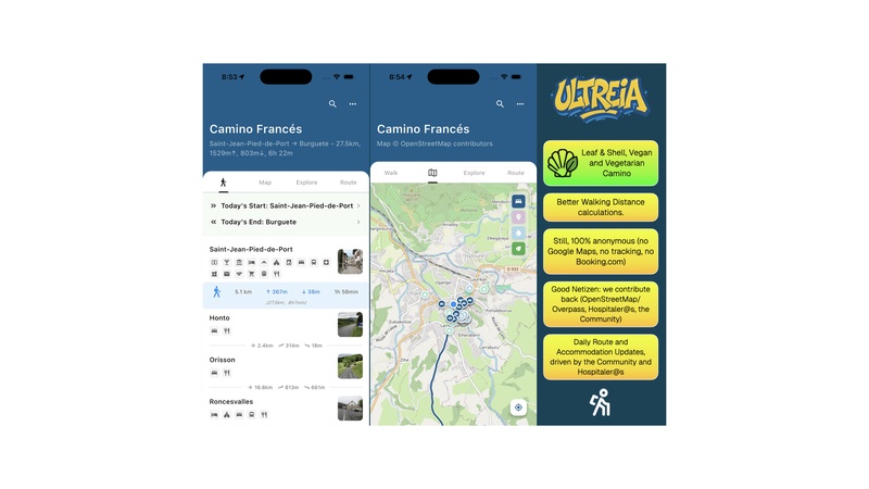
Ultreia 3.0
After this year's #Camino walks, we finally get to go back to making deep changes to the app. #CaminoNow is now #Ultreia (insert long story about legal threats and how much of an insane asshole assembly the "Camino App" world is here). Ultreia should be available in very early 2026, with a few super cool additions:
- Leaf & Shell Vegan and Vegetarian Camino Planning
- 100% Community, 100% good Netizen
- Better a11y design, usable by a wide variety of visually impaired and dyslexic users
- Translation ready, 15+ languages arranged to be contributed this year
- 80% of the code will be Open Source as libraries for others to implement Camino services.